

LIVE YOUTUBE VIDEOS
-

હિન્દુ યુવા સંગઠન સેલારી દ્વારા મહાશિવરાત્રી પર્વની ઉજવણી કરવામાં આવી
-

શ્રી સ્વામિનારાયણ ગુરુકુળ રાપર ખાતે ગુરુકુળનો 22મો વાર્ષિક ઉત્સવ ઉજવાય ગયો.
-
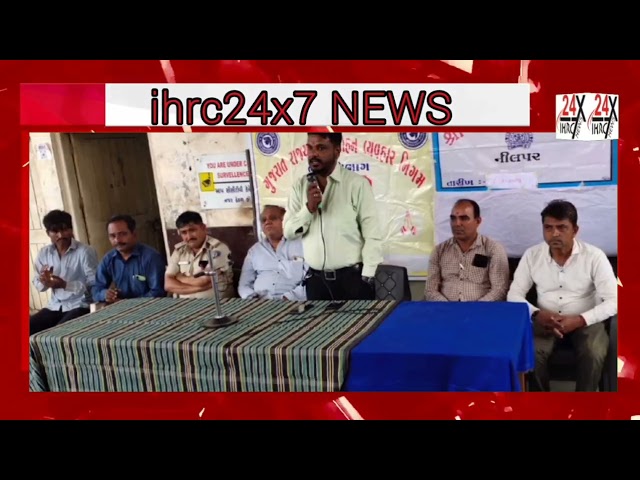
શુભ યાત્રા સ્વચ્છ યાત્રા અંતર્ગત રાપર ST ડેપો દ્વારા બસ સ્ટેશન ખાતે વ્યસન મુક્તિ કાર્યક્રમ યોજાયો..
-

ઘાણીથર પાટિયા પાસે માટીની વિદેશી દારૂના કટિંગ ટાઈમે ગાગોદર પોલીસે દારૂનો જથ્થો ઝડપ્યો


Trending News
-
Mostbet Aviator Nadir Demo Oyunu O’ynaydi Va Para Uchun Mosbet Com Saytidan Yuklab Oling
Lakin daha şey turnirin populyarlığından və konkret matçdan asılıdır. Əgər Çempionlar Liqasının qrup mərhələsinin matçı haqda danışırıqsa, deməli, bukmekorun komissiyası…
Read More »


